Let's walk the Michinoku Coastal Trail <Sanriku Coastal Municipalities>
- Hirono-town
- Kuji-city
- Noda-village
- Fudai-village
- Tanohata-village
- Iwaizumi-town
- Miyako-city
- Yamada-town
- Otsuchi-town
- Kamaishi-city
- Sumita-town
- Ofunato-city
- Rikuzentakata-city
- Michinoku Shiokaze Trail
- Sanriku Geopark
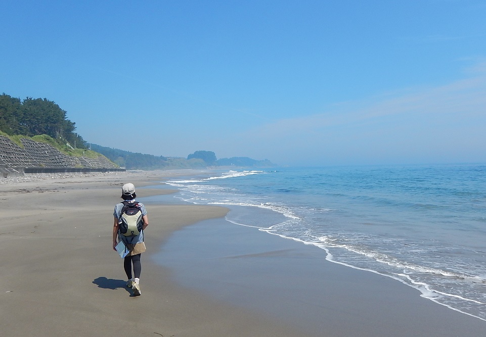
Outdoor popular in recent years, it has been attracting attention trekking Activity "Michinoku sea breeze Trail" to enjoy walking slowly long trail of coastline.
On the Sanriku coast of Iwate prefecture, there are many recommended routes where you can experience not only the beauty of the landscape, but also the history and culture, and the encounters with the people who live there.
We have compiled a list of related sites that you can check on the Internet, so please try the route that interests you ☆
[Information on Michinoku Shiokaze Trail Route]
When walking on the Michinoku Coastal Trail, carry a map and check the route locally.
The map "Hiking Map Book" published by Michinoku Trail Club can be purchased online.
You can also download GPX format data. For details, please see the website below.
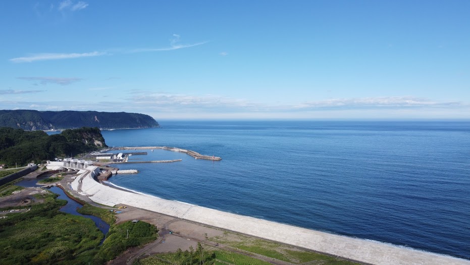
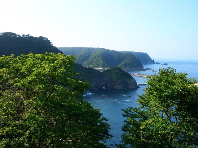
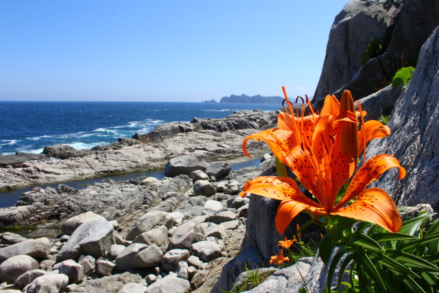
* The photo on the top page is Yamada Bay seen from Karogatake, Yamada Town.
* Reference HP: Ministry of the Environment Michinoku Sea Breeze Trail http://tohoku.env.go.jp/mct/
◎ Hirono Section (Iwate Prefecture) Hirono Section
[Hirono Town / Uge Beach]
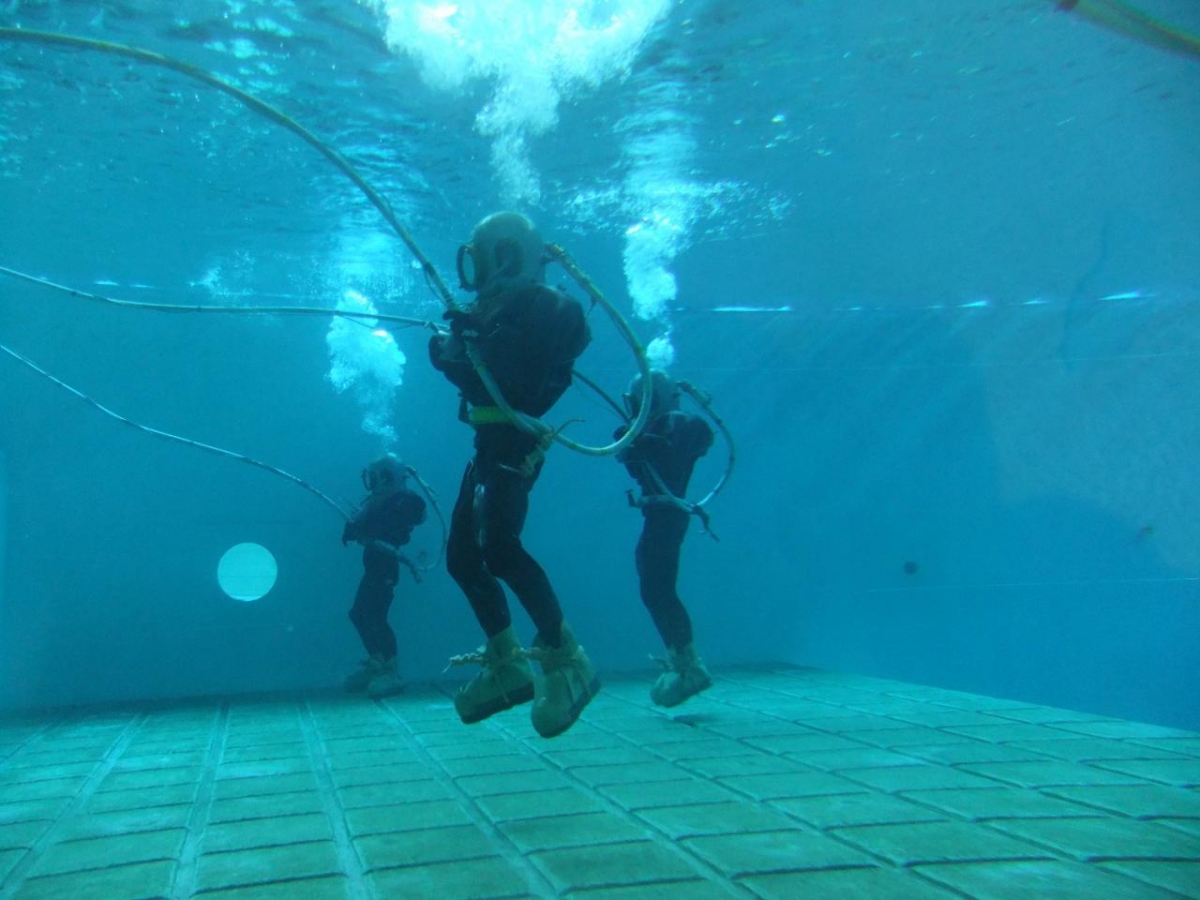
[Hirono Town / Taneichi High School Southern Moguri]
It is a route to walk in Hirono Town, which is famous for sea urchin, abalone and sea squirts. In addition to enjoying seafood during the season, you can also experience the history and technology of the fishing industry, such as the "growth fishing port" Shukudogyo Harbor and the "Southern Moguri" Taneichi High School. There is a route that walks near the coast with no height difference, but there is also a swamp crossing point near Nakano Shirataki.
Hirono Town Route Model Course Details
◆ Hirono Town Sanriku Gastronomy (Click to jump to the restaurant information page)
◎ Kuji City Route (Iwate Prefecture) Kuji Section
[Kuji City / Samuraihama]
It is a route to walk through Samuraihama, which runs through the forest near the sea, the Kosode coast, which is known for the "northern ama" and strange rocks, and Kuji city (detour). There are plenty of attractions such as the scenery of rough waves hitting the bedrock, the appearance of seabirds raising children, and the location of the drama. There is also a place related to Minamoto no Yoshitsune.
Kuji City Route Model Course Details
◆ Kuji City Sanriku Gastronomy (Click to jump to the restaurant information page)
◎ Noda to North Fudai Section (Iwate Prefecture)
[Noda Village / Jufugaura Seawall]
It is a route where you can be healed by the idyllic scenery of Tofugaura and the scenic spots of the Tamagawa coast. There are plenty of activities and food such as salt making experience, mine exploration, and exquisite scallops. There are many slopes along the coast, and walking in a satoyama area requires physical strength. If you go to the detour Unotori Shrine Okumiya, it will be a mountain road at an altitude of 424m.
Noda Village-Fudai Village Northern Route Model Course Details
◆ Nodamura Sanriku Gastronomy (Click to jump to the restaurant information page)
◎ Southern Fudai Village-Tanohata Village-Northern Iwaizumi Town Route (Iwate Prefecture) South Fudai to Tanohata to North Iwaizumi Section
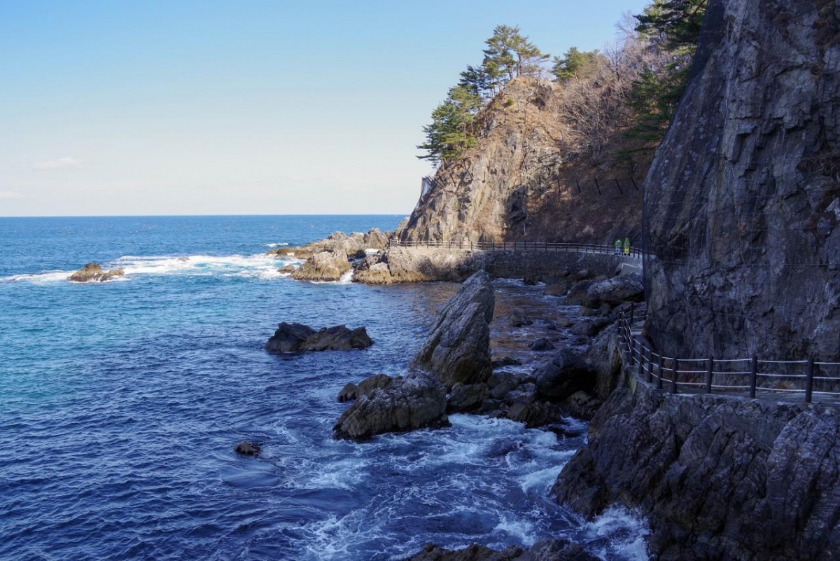
[Fudai Village / Nedarihama Nature Trail]
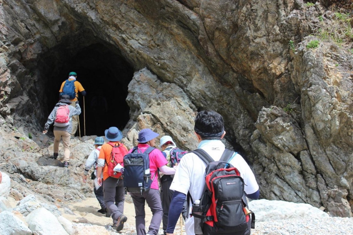
[Tanohata Village / Hand-dug tunnel]
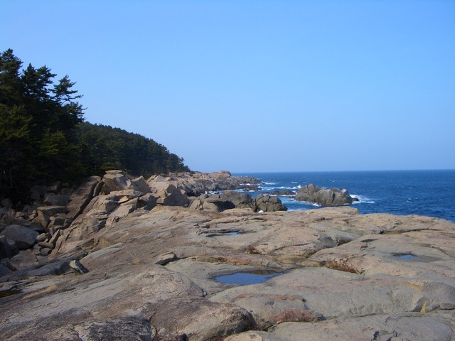
It is a route that goes along the coastline with harsh terrain approaching cliffs. The shores, steep ups and downs, quiet forests, pitch-black hand-dug tunnels and the Michinoku Sea Breeze Trail are an adventurous route. There is also an observatory where you can see the best scenery of Sanriku such as Kurosaki, Kitayamazaki, and Unosu Cliff, so it is a recommended route that will satisfy even those who are accustomed to the mountains.
◆ Fudaimura Sanriku Gastronomy (Click to jump to the restaurant information page)
◆ Tanohata Village Sanriku Gastronomy (Click to jump to the restaurant information page)
◎ South Iwaizumi to North Miyako Section (Iwate Prefecture) South Iwaizumi to North Miyako Section
[Iwaizumi Town / Kumanohana Observatory]

[Miyako City / Sawajiri Coast]
It is a route that goes through the forest "Alps of the Sea" right next to the coast. From Kumanohana Observatory, Masaki Observatory, and Sannoiwa Park, you can enjoy a magnificent view overlooking the seafood cave, peninsula, and huge rocks. Therefore, although there are ups and downs, the route has an attractive view that you will never get tired of.
Details of the route model course from southern Iwaizumi to northern Miyako
◆ Iwaizumi-cho Sanriku Gastronomy (Click to jump to the restaurant information page)
◎ Northern Miyako City-Central Miyako City Route (Iwate Prefecture) North to Central Miyako Section
.jpg)
[Miyako City, Sakiyama Blowhole]
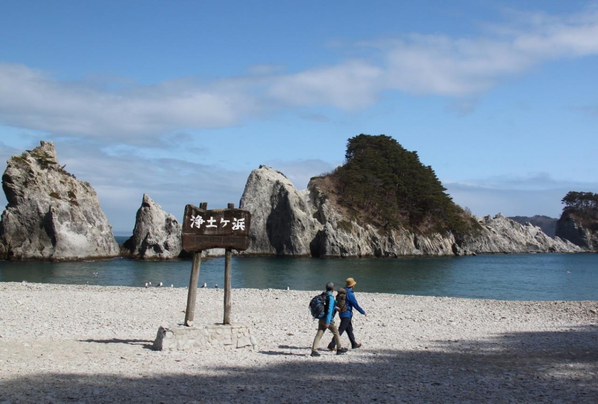
[Miyako City, Jodogahama]
A route that goes up and down the "Sea Alps" in Miyako City. It is a route where you can experience the contrast between the dynamic scenery such as the tide hole where the tide rises as much as 30m and the 60m cliff of Anegasaki Observatory and the beautiful and gentle scenery of Jodogahama.
Miyako City Northern-Miyako City Central Route Model Course Details
◆ Miyako City Sanriku Gastronomy (Click to jump to the restaurant information page)
◎ Miyako City Southern Route (Iwate Prefecture) South Miyako Section
[Miyako City / Cape Todo Coast]
It is a route that goes around the Omoe Peninsula, which has the cape "Korigasaki" at the easternmost point of Honshu, where you can feel the cityscape that has survived natural disasters. Lessons and memories of the areas that have experienced the tsunami, such as the tsunami stone monument of Aneyoshi and the display showing the height of the tsunami, are left in various places. The Omoe Peninsula is a route that requires physical strength to cross many mountains and passes, including Mt. Gassan, which overlooks the city of Miyako from the summit, but it is also a place that can be said to be an unexplored region of Sanriku where you can see giant red pine trees and a beautiful natural coast. ..
◆ Miyako City Sanriku Gastronomy (Click to jump to the restaurant information page)
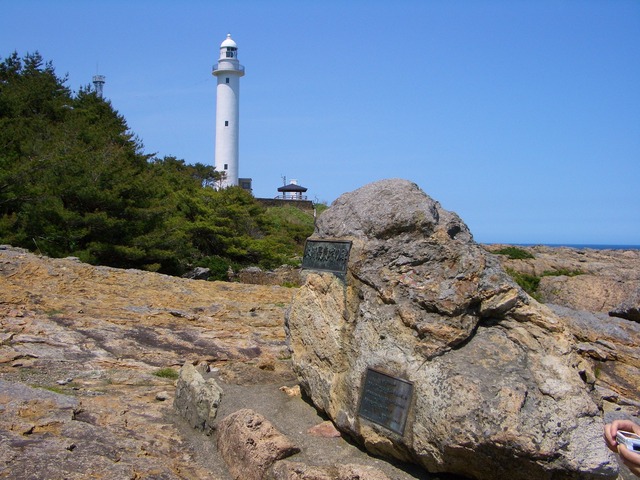
◎ Yamada Town Route (Iwate Prefecture) Yamada Section
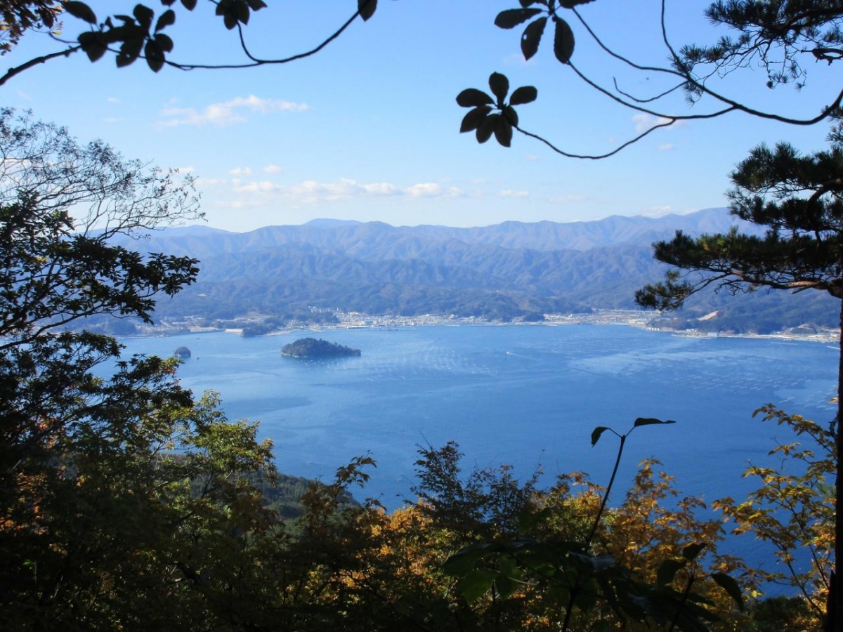
[Yamada Town / Karogatake]
[Yamada Town / Arakami Beach]
It is a route that goes around Yamada Bay, which is as beautiful as lake water, and goes around the Funakoshi Peninsula, where huge beech and pine trees remain in remote areas. Oshima (Netherlands) and Kojima are uninhabited islands in Yamada Bay. It is a symbol of Yamada Bay, where oyster and scallop farming shelves spread. Although it is a fisherman's town, there are rice fields and fields near the sea, and you can enjoy the atmosphere of a satoyama. The road from Sukuiso Coast on the Funakoshi Peninsula to Karogatake is a route that connects 0m above sea level to the summit. Even those who like mountaineering can enjoy it.
◆ Yamada Town Sanriku Gourmet Place (Click to jump to the restaurant information page)
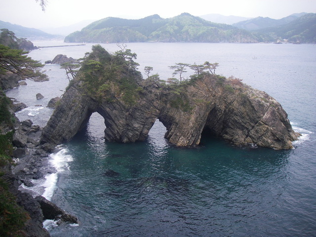
◎ Otsuchi Town Route (Iwate Prefecture) Otsuchi Section
[Otsuchi Town / Horai Island]
This route is full of unique charm. Horaijima, which is famous as a model of Hyokkori Gourd Island, is a small and cute island, unlike the powerful cliff islands that are often found in Sanriku. The town is rich in spring water, and you can observe the freshwater-type three-spined stickleback swimming in the clear water up close in the source water river. In addition, it is a route where you can enjoy climbing Mt. Kujirayama and exploring the history of Shiroyama Park.
◆ Otsuchi-cho Sanriku Gastronomy (Click to jump to the restaurant information page)
◎ Kamaishi City Route (Iwate Prefecture) Kamaishi Section
[Kamaishi City, Senjojiki]
A route that walks along the coastline along the cape of the Rias coast, the historical road of the Sanrikuhama Highway, and the city of Kamaishi. From the cape, you can enjoy a magnificent view of Sanganjima Island and Senjojiki. In addition, it is a route to learn about the nature of Kamaishi and the history of the town while visiting the iron museum.
◎ Ofunato City North to Central Ofunato Section (Iwate Prefecture) North to Central Ofunato Section
[Village of Ofunato City, Yoshihama]
[Ofunato City, Hodai Pass]
It is a route that goes around the Sanrikuhama Highway that passes through the Kuwadai Pass and the Rasho Pass, and the cape of Ryorizaki, which boasts a beautiful cliff. In the meantime, there are spots with unique traditional culture such as Yoshihama village and Ryori Daigongen, local shops lined up, and symbols of reconstruction such as Cassen Ofunato aiming to revitalize the town. Don't miss the famous seafood such as abalone and scallops.
Ofunato City North Central Route Model Course Details
◆ Ofunato City Sanriku Gastronomy (Click to jump to the restaurant information page)
◎ Ofunato City Central to South Ofunato Secton (Iwate Prefecture) Central to South Ofunato Secton
[Ofunato City, Anatoshi Iso Goishi Beach]
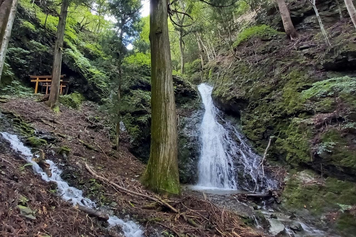
[Ofunato City, Ryori Pass Fudo Falls]
It is a route that goes through the ridge of Ryori Pass, goes through Ofunato Port, and goes around the scenic spots of Goishi Beach. It is a route with abundant greenery of Ryori Pass with Fudo Falls, Ofunato Port, which is the largest in the prefecture, Goishi Beach with a rough view of strange rocks, islands and caves, and attractions.
◆ Ofunato City Sanriku Gastronomy (Click to jump to the restaurant information page)
◎ Rikuzentakata City Route (Iwate Prefecture) Rikuzentakata Section
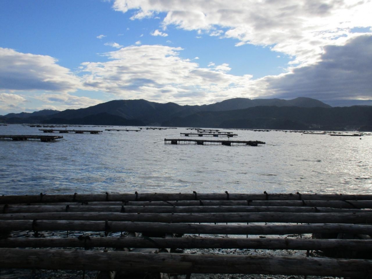
[Rikuzentakata City / Hirota Bay]
It is a route where you can feel the threat of nature that caused the Great East Japan Earthquake and the strength of reconstruction. Around Takata Matsubara, which was particularly severely damaged by the earthquake, there are many earthquake remains, including the miraculous Ipponmatsu. You can also enjoy the scenery created by people's livelihoods, such as the oyster rafts in Hirota Bay and the apple fields in Yonezaki Town.
◆ Rikuzentakata City Sanriku Gastronomy (Click to jump to the restaurant information page)